🎓 Remote sensing data analysis for scientific research
🧬 Consulting and guidance in satellite image processing
📚 Specialized support for theses and articles
Collaboration on Commercial Projects
💼 Spatial data analysis for businesses
🗺️ Providing up-to-date satellite imagery
📊 Data processing and modeling for better decision making
Education & Latest Remote Sensing News
🎥 Video tutorials on remote sensing from basic to advanced
📰 Latest technologies and articles in the field
🛰️ Introduction to image processing tools and software
Remote Sensing Specialized Services | Training, Analysis, and Consultation
:We are here to guide you on your journey of learning, research, and executing projects related to remote sensing. Our services include
✅Specialized training – from basic to advanced concepts, practical and project-based. ✅Collaboration in remote sensing research and commercial projects– work with an expert team to achieve the best results. ✅Providing satellite and aerial imagery – delivering precise data tailored to your project needs. ✅The latest news and technologies – stay updated with the newest developments in the field of remote sensing.
🛰️ Steps to Conduct a Remote Sensing Project
📌 1. Needs Assessment & Problem Definition
First, the main objective of project must be defined. We consult with the client to identify data types, time period, study area, and final goals.
🗺️ 2. Data Collection & Preparation
At this stage, we acquire the required satellite images from reliable sources and perform geometric and spectral corrections.
📊 3. Image Analysis & Processing
Depending on the project type, we analyze data using classification algorithms, index extraction, or advanced modeling techniques.
📄 4. Results Delivery & Final Report
The results are provided in the form of maps, charts, written reports, and technical documentation. If needed, we also offer support until project completion.
If you need guidance for your project, feel free to contact us right now📩
Why Is Remote Sensing Important
Today, it is possible to study and monitor changes on Earth without physical presence. Using data collected from space, we can gain valuable information about land surfaces, the atmosphere, and water resources Analyzing this information helps researchers, farmers, engineers, and decision-makers to act more accurately, predict and manage environmental changes
Monitor the Earth from the Sky; Precise, Extensive, and Scientific
:Remote sensing is widely used in many fields, including Predicting climate changes and reducing environmental risks Monitoring agriculture and managing natural resources Urban analysis, mapping, and sustainable development
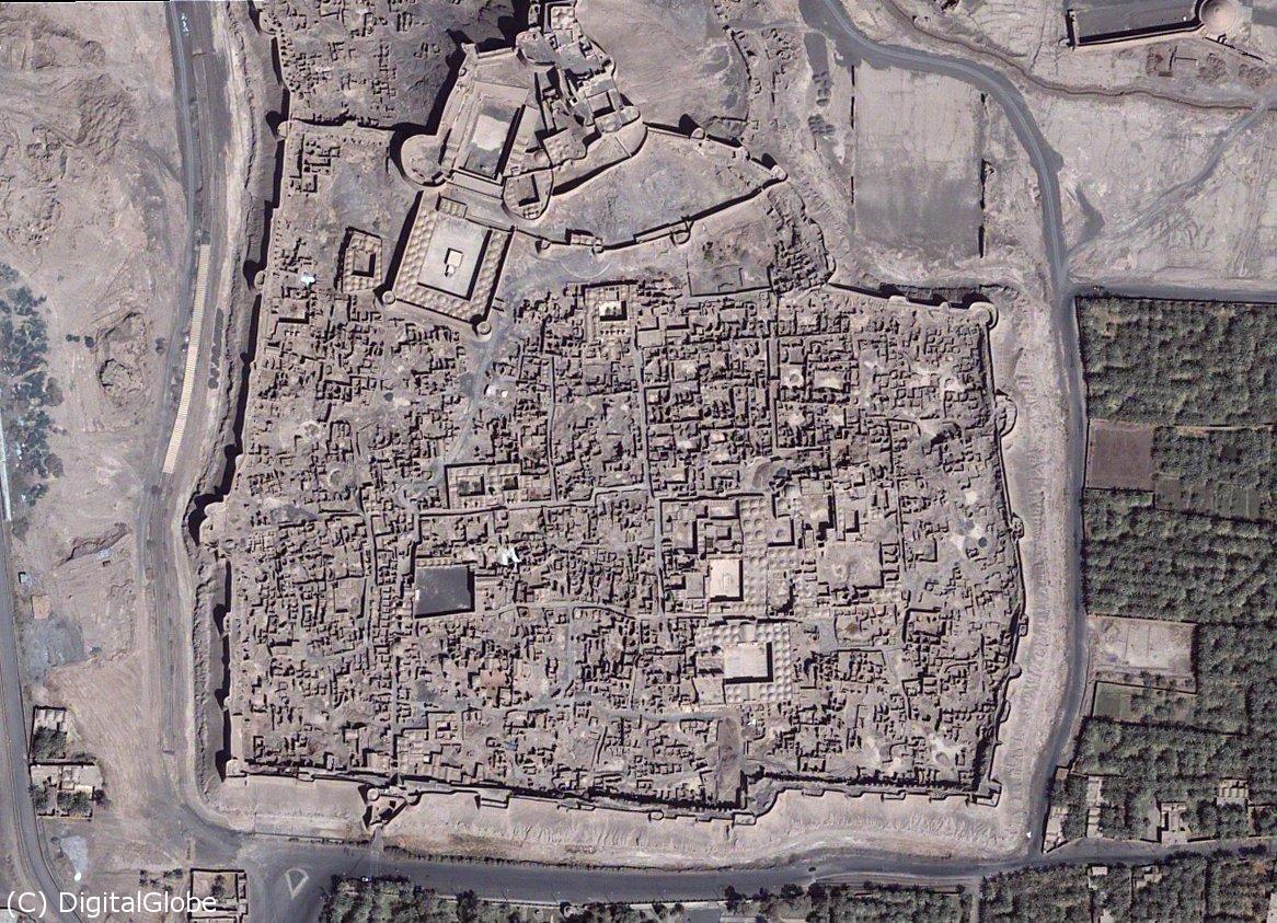
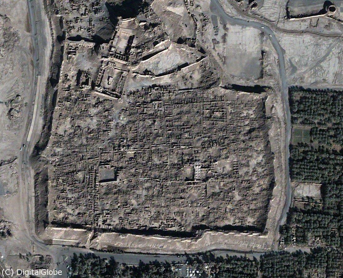
Detecting Bam Citadel Earthquake Damage with QuickBird Satellite
By applying this science, we can make smarter decisions, increase efficiency, and build a more sustainable future📊
.Stay up to date! New tutorials, exclusive videos, and the latest developments
🎥 Watch remote sensing videos on YouTube (click the image)
Some of the completed research and commercial projects
For better viewing of the images, please rotate your device to landscape.
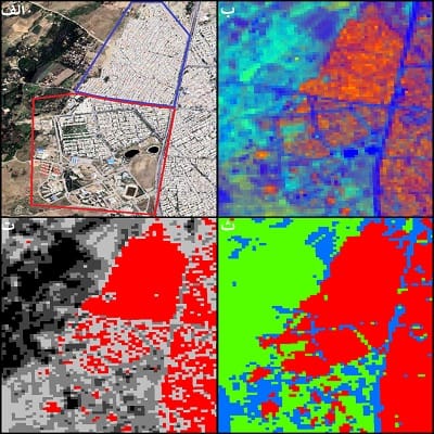
Comparison of urban classification methods in the metropolitan area of Hamedan
Image A: Google Earth satellite image |
Image B: Spectral Mixture Analysis |
Image C: Spectral indices related to land cover |
Image D: SVM classification output for separating urban land uses
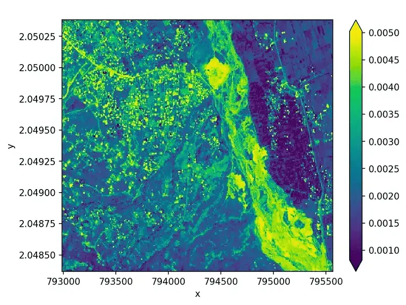
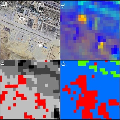
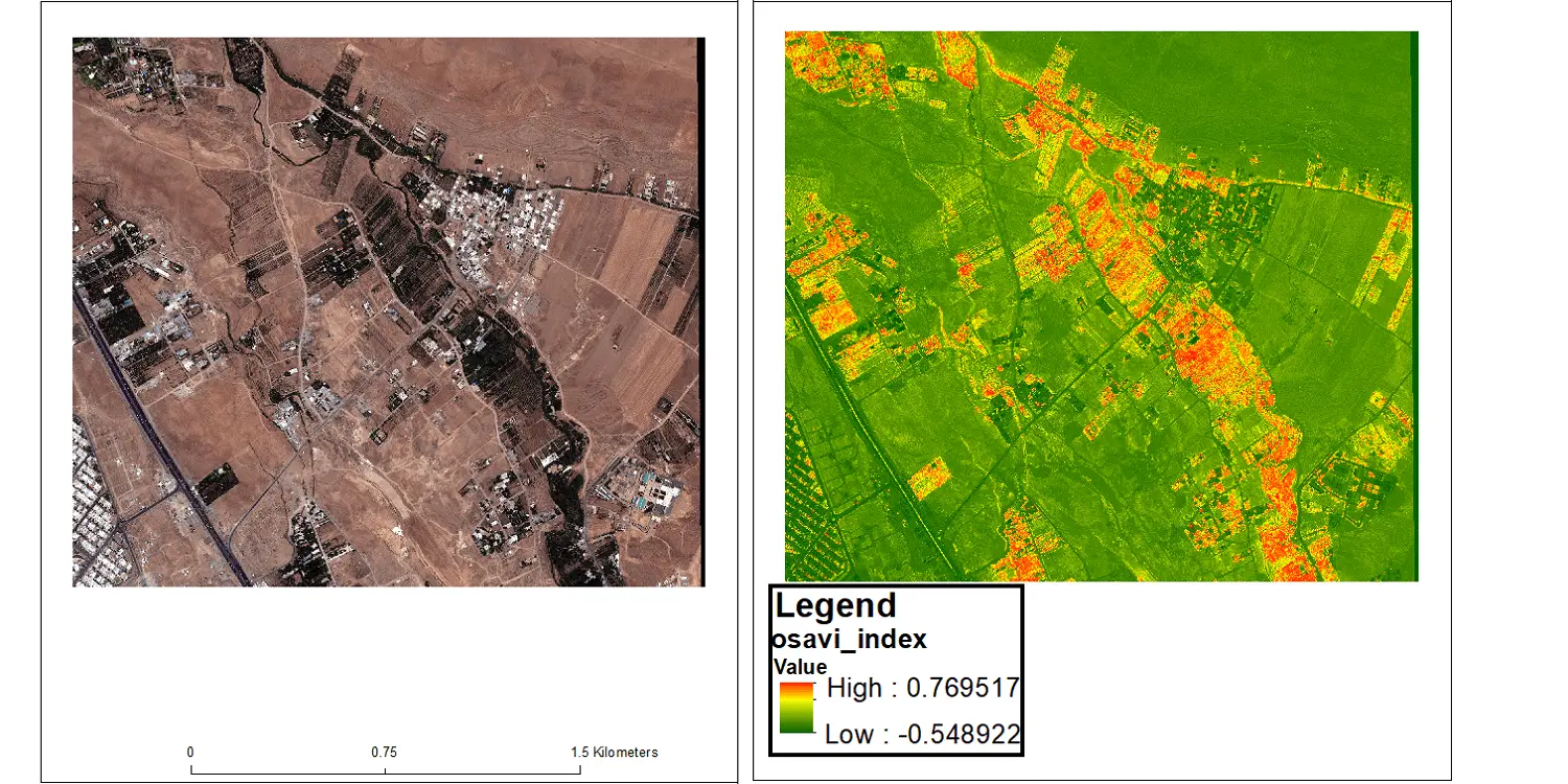
Evaluation of soil salinity indices in Ghalat village, Shiraz
In this study, various indices were examined to identify the index closest to the actual soil salinity.
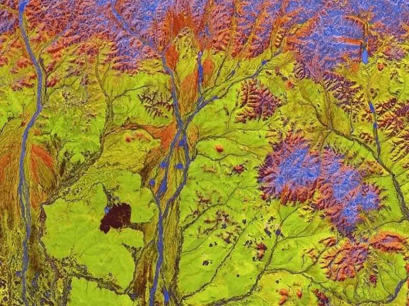
Georeferencing Corona satellite imagery
Creating a georeferenced image of the Corona reconnaissance satellite (left) and comparing it with a 1970s image of Tehran (right) for urban change analysis and evaluation of land reform plans.
Satellite data is our expertise — broad coverage across leading satellites
Satellite title
Hello
Why entrust your projects to us?
Accuracy, experience, and fair pricing – all in one expert team!
Full support until the best possible result is achieved
Supply of aerial and satellite imagery tailored to your project's needs
Proven collaboration with reputable companies and understanding real client needs